Braun, Georg - Hogenberg, Frans: Eisenstadium vulgo Eisenstat... — Mannersdorf
Cologne, 1617.
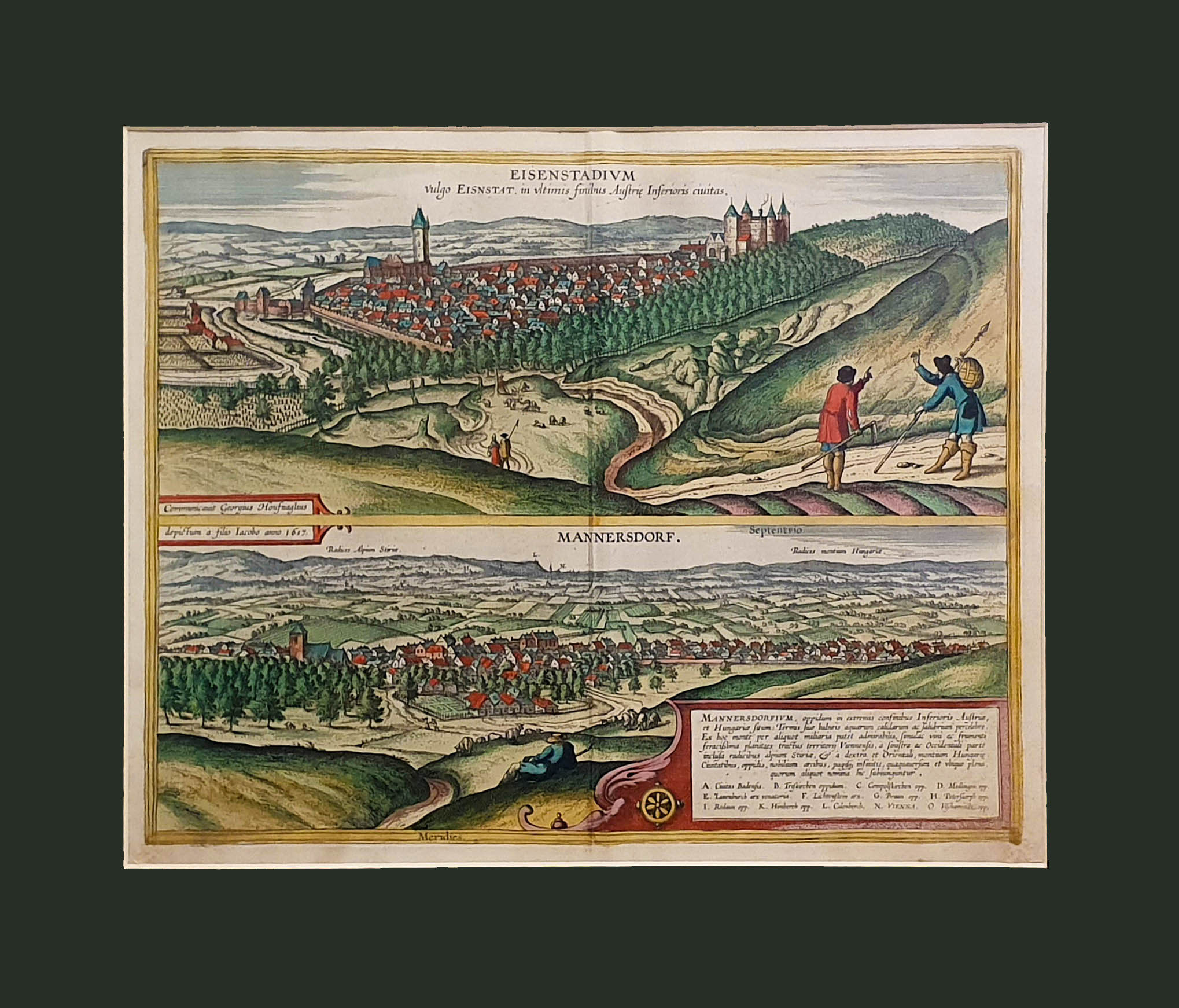
Kismarton's skyline, on the same page as Lower Austria's Mannersdorf. Ortelius' "Theatrum orbis terrarum", the first real atlas, served as a model for Georg Braun and Frans Hogenberg's monumental cityscape collection, "Civitates orbis terrarum", in which the above page first seen_cc781905-5cde-3194- bb3b-136bad5cf58d_daylight. Between 1572 and 1617, bird's-eye views of more than 500 cities and castles were published on approximately 360 pages in six volumes. The explanatory text accompanying the pictures was written by Georg Braun, the scholarly canon from Cologne. His publishing partner, Frans Hogenberg, who fled the Low Countries, was a painter and engraver (after his death, his son Abraham continued his work). With the help of Simon van den Neuwel (Novellanus), the engravings were made from the site plans. More than a hundred artists and cartographers contributed to the monumental work, including Jacob van Deventer, Heinrich van Rantzau, and perhaps the best known, the painter and draftsman who fled from Amsterdam, Georg (Joris) Hoefnagel. This representation was made by Georg Hoefnagel's son, Jacob. Originally the VI. was published in 1617 on page 22 of vol. The city could be included in the series because it was a Habsburg estate at the time, and it also had a large area surrounded by the city wall. The picture taken from the west is dominated by the Gothic parish church to the left and the idealized castle - which stood on the site of today's Esterházy Castle - to the right. To the left of the town are grape hills, and to the right in the foreground are the figures of two peasants.
Size: 195 x 475 mm.